Network analyses of foreign travelers through Wallachia, Moldavia and Transylvania
CORE Admin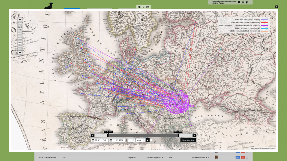
Petrus Andrei Gabriel, Universitatea Babeș-Bolyai, Cluj-Napoca, Romania One of the best known contemporary Romanian historians, Sorin Mitu, stated that small nations often tend to pay a special attention to foreign accounts narrating about their historical reality. On the one hand, because foreign travelers are the fiercest critics of the space they pass through, on the other hand, because these types of accounts shed light on the darkest and most inaccessible corners of society, where historians could hardly reach without the help of those who traveled through or even settled down. Starting from Mitu’s idea, I wanted to research these testimonies from another perspective. Working with traditional means, I found it really difficult and it took me a lot of time to write down all important aspects about travelers and then to group them by professions, education or even route, in order to make any type of analysis. This difficulty was the main reason behind my desire of developing a database which can include various facts about travelers and can be accessible to anyone for further studies. nodegoat suits this goal perfectly. The platform allows researchers to compile large databases and to analyze their data relying on network-type connections.
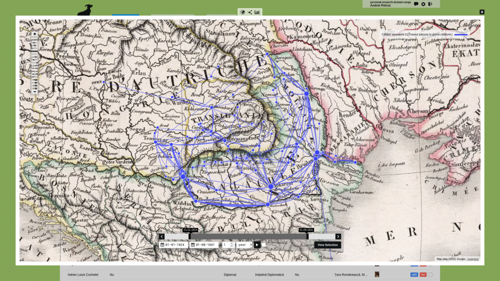
The main source used by the project are the travel memoirs of foreigners visiting the Romanian Principalities during the 1830s. The objective of the project was to map, by means of nodegoat, a series of variables related to the biographies of the foreign travelers and test the analytical possibilities offered by such approach. I have included information on the geographical space of origin, the university studies, the frequency of short and long-term trips and their purpose, the route, but also the places that made travelers divert from original itinerary. So, I created various easy-readable and modellable graphs (geographical, social and chronological) which show differences and similarities between travelers. Less effort is now needed for complex analyses which could otherwise have taken a long time and the results might have been less accurate than what we are able to present now.
Public User Interface: nodegoat.net/viewer.p/71
Publication: ceeol.com/search/article-detail?id=925679